- Home
- Blog
- Augmented Reality and Weather Prediction: How AR Technology Helps Us Prepare for Extreme Weather
Innovation · 6 min read
Augmented Reality and Weather Prediction: How AR Technology Helps Us Prepare for Extreme Weather
Discover how augmented reality (AR) and AI combine to visualize weather predictions and help Indonesia prepare for extreme weather events.
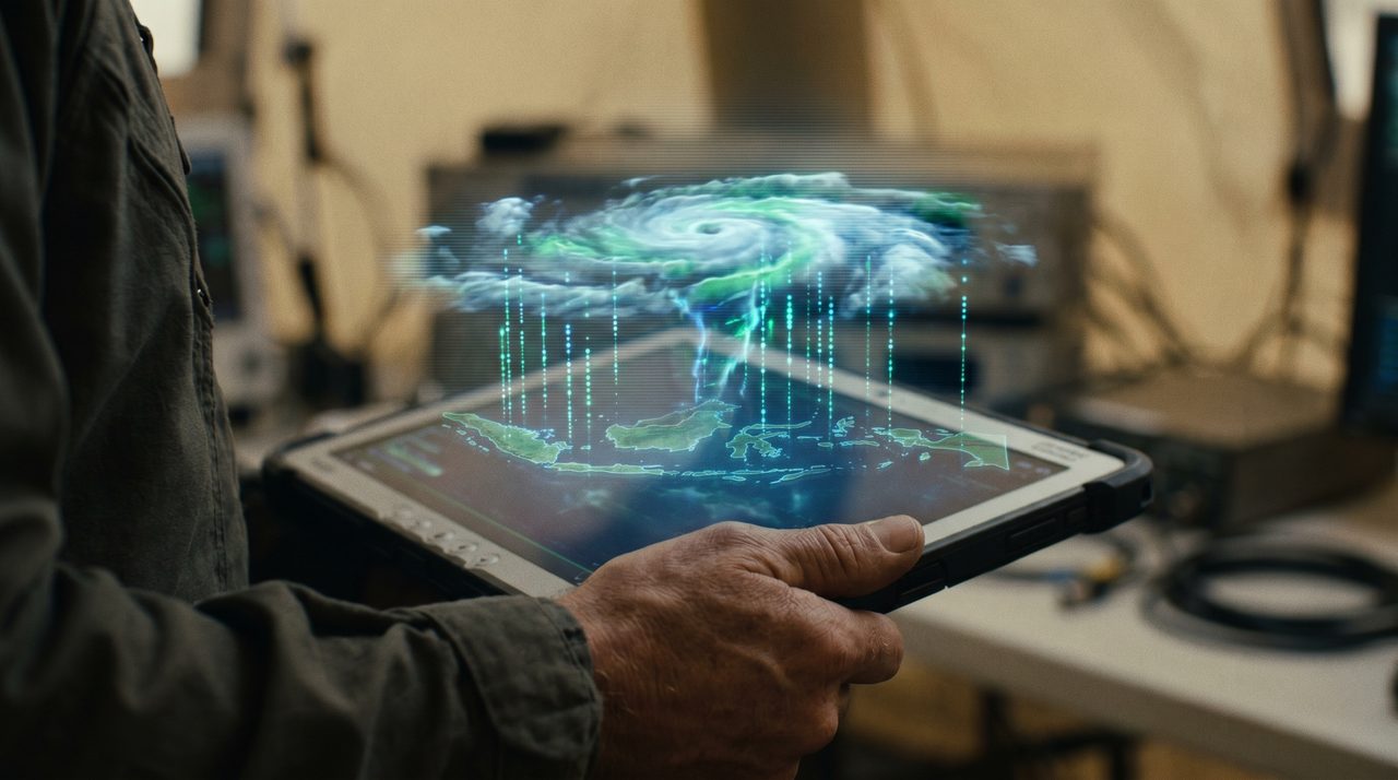
Augmented reality (AR) is rapidly moving beyond gaming and e-commerce—today it stands at the frontier of emergency preparedness and climate science. When Yogyakarta experienced a rare and unexpected hailstorm in early 2025, the event underscored a gap: most people had no visual, real-time warning of what was about to happen. AR technology, combined with artificial intelligence, has the potential to close that gap—turning abstract meteorological data into vivid, interactive visualisations that ordinary people can act on.
How Augmented Reality Transforms Weather Forecasting
Traditional weather forecasting delivers its message through text bulletins, colour-coded radar maps, and TV graphics. These formats work, but they demand a level of meteorological literacy that most people do not have. AR flips this model: instead of asking users to interpret data, it layers the forecast directly onto the world they can already see.
Here is how AR makes weather prediction more accessible and actionable:
- 3D Weather Visualisation. Point a smartphone at the sky and see a live AR simulation of an approaching storm system—rain bands, wind vectors, and hail probability overlaid on the actual horizon. Users in cities across Indonesia, from Jakarta to Surabaya to Makassar, can receive geographically precise previews of incoming weather within minutes.
- Real-Time Contextual Alerts. AR glasses or phone screens can display colour-coded hazard zones on a live camera feed—flooding risk in low-lying kampung areas, lightning corridors above open fields, or flash-flood channels along river banks—giving residents time to move to higher ground or take shelter.
- Interactive Education and Simulation. Schools, BMKG (Indonesia’s Meteorology, Climatology, and Geophysics Agency) outreach programmes, and disaster-preparedness NGOs can use AR simulations to teach communities what a Category-4 tropical storm looks like from the inside, long before one makes landfall.
Combining AR and AI for More Accurate, Personalised Predictions
The real power of AR in weather science emerges when it is paired with machine-learning models. AI can ingest enormous volumes of satellite telemetry, ground-sensor readings, Doppler radar sweeps, and historical climate records simultaneously—then distil that torrent of data into a single, human-readable AR layer delivered to a user’s device in seconds.
Consider a practical example: an AR-enabled weather app connected to an AI forecasting engine could detect the atmospheric conditions associated with hail formation—strong updrafts, super-cooled water droplets, deep convective cells—and then render an animated 3D hail simulation over a user’s camera view up to 30 minutes before the event. Instead of reading “possible hail” in a text notification, a farmer in Sleman or a motorcyclist in Jakarta sees exactly how intense and localised the threat is, and can respond accordingly.
AI also enables personalisation. A logistics operator routing delivery trucks across Java gets wind-speed overlays relevant to large vehicles. A rice farmer in West Kalimantan gets crop-stress heatmaps. A resort manager in Bali gets wave-height projections for the beach. The same AR infrastructure, tuned by AI to each user’s context, delivers radically different—and radically more useful—information.
For organisations already exploring immersive technology, VR simulation platforms offer a complementary training environment: staff can rehearse disaster-response protocols in photo-realistic virtual scenarios before real events occur.
Real-World Impact Across Industries in Indonesia
The applications of AR-powered weather intelligence extend well beyond individual consumers. Several sectors stand to benefit enormously:
- Tourism and Outdoor Recreation. Indonesia’s tourism industry, which spans diving in Raja Ampat, hiking on volcanoes in Java, and surfing in Lombok, is acutely sensitive to weather. AR travel apps could display real-time sea-state and wind-gust overlays at specific GPS coordinates, helping operators and visitors make informed go/no-go decisions with far greater confidence than static forecasts allow.
- Transportation and Logistics. Truck drivers, ojek riders, and maritime shipping operators across the archipelago contend with sudden squalls, flash floods, and dense fog. AR navigation tools that overlay road-flooding probability and visibility forecasts directly onto a driver’s windscreen—or a captain’s chart display—could prevent accidents and reduce costly delays.
- Agriculture and Food Security. Indonesia’s agricultural sector, which employs tens of millions, is highly vulnerable to rainfall variability and extreme events. AR field tools that help farmers visualise soil-moisture trends, pest-pressure forecasts, and irrigation windows could meaningfully improve yield predictability and reduce crop losses.
- Urban Disaster Management. City governments in flood-prone areas like Jakarta can use AR dashboards to visualise inundation models, evacuation routes, and emergency-resource positions overlaid on live street-view maps—enabling faster, better-coordinated emergency response.
The Technical Pathway: From Data to Visualisation
Building a production-grade AR weather system involves several interlocking technology layers. First, high-frequency data ingestion pipelines must pull from satellites (NOAA, BMKG, ESA Sentinel), ground weather stations, and community-sensor networks. Second, AI forecasting models—deep-learning architectures such as graph neural networks or transformer-based models—generate probabilistic outputs at fine spatial resolutions. Third, a rendering engine maps those outputs to 3D geometry and anchors them to real-world coordinates using the device’s GPS, compass, and camera. Finally, a lightweight AR SDK delivers the experience to consumer-grade hardware: an Android phone, an iOS device, or a wearable AR headset.
Crucially, this architecture scales. A system built to visualise hail risk over a single district can, with additional data feeds, be extended to visualise air-quality indices, earthquake early warnings, or wildfire smoke plumes—making it a general-purpose environmental situational-awareness platform for Indonesia and beyond.
Challenges and the Road Ahead
Bringing AR weather tools to mass adoption in Indonesia is not without obstacles. Device penetration varies enormously between urban and rural areas; connectivity remains intermittent across much of the outer islands; and localised training data for AI models is still sparse compared with wealthier, more densely instrumented nations. Additionally, public trust in automated systems must be earned through demonstrable accuracy over time.
Nevertheless, the trajectory is clear. Smartphone penetration in Indonesia crossed 60 percent in 2024 and continues to climb. 4G coverage is expanding rapidly, and the government’s Palapa Ring satellite-backbone project is closing the rural connectivity gap. As these infrastructure preconditions mature, the cost and complexity of deploying AR weather applications will fall, and their potential impact will grow.
Conclusion: AR Is the Future of Weather Preparedness
Augmented reality is no longer a novelty technology confined to marketing campaigns or entertainment. It is emerging as a serious tool for public safety—one that can translate complex meteorological science into vivid, instantly actionable visualisations that save lives and protect livelihoods. For Indonesia, a nation that sits in one of the world’s most weather-volatile regions, the case for investing in AR-powered weather intelligence is compelling.
InReality Solutions is at the forefront of immersive technology development in Indonesia. Whether you are a government agency, a corporate enterprise, or a community organisation, we can help you explore how AR and AI can strengthen your weather preparedness, emergency response, or environmental monitoring capabilities. Contact our team today to start the conversation.
Frequently Asked Questions
How does augmented reality help with weather prediction?
AR overlays real-time weather data—such as storm simulations, rain bands, and hazard zones—onto a live camera view on a smartphone or AR headset. Instead of reading text forecasts, users see a 3D visualisation anchored to their actual surroundings, making it easier to understand and act on weather warnings.
Can AR weather apps work in Indonesia's rural areas with limited connectivity?
Connectivity is a real challenge across Indonesia's outer islands, but lightweight AR apps can pre-cache localised forecast layers and update only the most critical data points over low-bandwidth connections. As 4G coverage expands under the Palapa Ring project, rural access will improve significantly.
What is the role of AI in AR-based weather forecasting?
AI processes vast streams of satellite, radar, and sensor data to generate probabilistic forecasts at fine spatial and temporal resolutions. It then feeds those predictions to the AR rendering engine, which anchors the visualisations to real-world coordinates on the user's device—delivering personalised, location-specific hazard information in near real time.
Which industries in Indonesia benefit most from AR weather technology?
Tourism and outdoor recreation, agriculture, transportation and logistics, and urban disaster management all stand to gain significantly. Each sector faces distinct weather-related risks, and AR can be tuned—via AI personalisation—to deliver the specific visualisations most relevant to each use case.
How is AR weather technology different from VR disaster simulations?
AR overlays digital information onto the real world in real time, making it ideal for live situational awareness and public alerts. VR creates a fully immersive simulated environment, which is better suited to training scenarios—such as rehearsing emergency-response protocols before a real disaster strikes. The two technologies complement each other.

Content Specialist, InReality Solutions
Ready to Build Your New Reality?
Tell us about your brand and goals — we'll show you what's possible.